
Wedder Hill [Blackside]
Good walks are even better shared.
Overview
Introduction
Wedder Hill, also known by its local moniker Blackside, rises gracefully amidst the scenic Southern Uplands of Scotland. This delightful Marilyn offers not just a good workout, but splendid views that could make even a stoic-hearted person smile.
Geology
The geology of Wedder Hill offers a fascinating snapshot of Scotland's natural history. The predominant sedimentary rocks hint at an ancient marine environment, and the limestone found here is of particular interest to geology enthusiasts. Walking these slopes is akin to taking a stroll through time.
Routes
Blackside to Wedder Hill
This 5 km moderate route is perfect for hikers looking to stretch their legs without tackling a mountain-sized challenge. The path meanders through lush moorlands, making it a pleasant outing. Allow around 2 hours to enjoy a leisurely pace.
Mossdale Trail
A scenic 7 km loop trail that is suitable for families, the Mossdale Trail gives you the chance to explore the surrounding nature at a more relaxed pace. Expect to take approximately 3 hours.
Summit Features
At the summit, you’ll find a small stone cairn that not only marks the highest point but also serves as a great picnic spot if you fancy a snack with a view.
Terrain Type
The walk to Wedder Hill is predominantly moorland with grassy hopes that invite a comfortable hike. Just watch your step! There are some rocky outcrops that might want to trip you up if you're not paying attention.
Views
From the summit, the views are simply breathtaking. On a bright sunny day, prepare to have your breath taken away by the rolling hills of the Galloway Forest Park and the distant Southern Uplands. The best times to appreciate these vistas are during autumn, when the trees explode in colour, or spring, when the landscape is alive with vibrant wildflowers.
Hazards
While Wedder Hill is inviting, it's essential to stay prepared. The weather can change faster than you can say 'Scottish summer', so always check forecasts before setting off. Also, the terrain can be boggy; waterproof footwear is highly advisable unless you fancy a splash!
Access
Parking is found at a small layby near Carsphairn, but be mindful that this area is not heavily trafficked by public transport. The best bet is to drive from Castle Douglas, which is also the closest town providing necessary amenities.
Facilities
Be sure to stock up on snacks and drinks in the nearby villages before you head out, as facilities on the hill itself are non-existent.
History
Wedder Hill's name hints at its wet, verdant surrounds. Historically, this area has been a sheep grazing ground, with evidence of timeworn sheepfolds adding to this hill's charm. It's a place where nature and history intersect beautifully, making it a delightful spot for both hikers and history buffs alike.
Conclusion
So, whether you're seeking solitude in nature or a family-friendly hike, Wedder Hill [Blackside] caters to both. Just remember to don your wellies and bring along a sense of adventure – you're in for a treat!
Explore routes near Wedder Hill [Blackside]
Public walks starting within 80 km of this hill. Nearby does not mean a route reaches the summit; check its map and access before setting out.
Motherwell: Strathclyde Loch full shoreline circuit
View route
Cambuslang Walk with Men Walking & Talking
View route
Paisley Walk with Men Walking & Talking
View route
Lochend Loch at Drumpellier
View route
Route planning notes
These notes describe possible approaches, not verified navigable routes or permission to cross land. Check current paths, local access rules and conditions before setting out.
Blackside to Wedder Hill
A well-defined path that guides hikers through rolling moorland and offers a gentle ascent, perfect for beginners or a leisurely outing.
Mossdale Trail
A scenic loop that circles around the hill with views of the neighbouring valleys; ideal for a family-friendly hike.
Make a day of it, together
Find someone to share the walk with, or organise a day out along a route you like.
Hill facts and local notes
Classifications
Elevation
434m
1,422 ft
Prominence
146m
Coordinates
55.5513, -4.2267
NS596308
OS Map
71
Explorer: 334
At the Summit
The summit is crowned with a small stone cairn that provides an excellent vantage point for the surrounding landscapes.
Terrain & Geology
Wedder Hill features primarily sedimentary rock formations with interesting limestone deposits. The surrounding area is noted for its geologically diverse landscapes, showcasing various erosion patterns.
Views & Scenery
On a clear day, you can see the alluring hills of the Galloway Forest Park and the rugged beauty of the Southern Uplands.
History & Heritage
Name Origin
The name 'Wedder' is believed to derive from the Scots word for 'wet' due to the area's prevalent dampness; 'Hill' is, well, a hill!
Historical Significance
Historically, this area was grazed by shepherds, and remnants of old sheepfolds can be found nearby.
Getting There & Facilities
Check current local access restrictions, parking rules and transport timetables before travelling. These notes do not confirm public access to the summit.
Parking
Parking is available at the small layby off the A713 near the village of Carsphairn, approximately 10 minutes from the starting point.
Public Transport
Limited public transport; best accessed via car. The closest bus service operates from Newton Stewart to Carsphairn.
Nearby Facilities
No facilities on the hill itself; however, local villages offer cafes and shops for rest and refreshment.
Safety Information
Known Hazards
- Variable weather conditions; be prepared for sudden changes.
- Moorland can be boggy, especially after rain; waterproof footwear is recommended.
General Safety Tips
- Check weather conditions before setting out
- Carry appropriate clothing and equipment
- Let someone know your planned route
- Take a map, compass, and GPS device
- Carry emergency supplies: food, water, first aid kit, torch
Hills
Some common questions about the hills answered
Are there group walks up Wedder Hill [Blackside]?
Many walkers use Walkmates to join or organise walks with others. You can check for group walks around Wedder Hill [Blackside] through the maps
Are there other walkers around Wedder Hill [Blackside]?
Activity varies by location and time, but Walkmates lets you see whether others have shared walks or shown interest in this area. Find other people through the walking friends search walking friends for Wedder Hill [Blackside] search or of course create your own walk for Wedder Hill [Blackside]
Can I organise a walk to Wedder Hill [Blackside]?
Yes. If there aren’t any walks listed already, you can create a walk and make it available for others to join.
If you're signed up to Walkmates, you can create a walk to Wedder Hill [Blackside].
How do I find a walk up this hill?
There are often multiple ways to walk this hill, depending on experience and route preference. Walkmates helps you explore walks and routes that others have shared.
Can I suggest a new route up Wedder Hill [Blackside]?
Yes. You can suggest or create routes to share with others. Walkmates focuses on the social side of walking, so routes are used to help people organise walks and explore areas together, rather than as detailed navigation tools or route libraries.
Other uses really appreciate knowledgeable walkers sharing their routes. Share your favourite route to Wedder Hill [Blackside] here
The is an error or something incorrect about this hill. How do I let you know?
We always strive to keep the information on Walkmates as accurate as possible. If you find an error, please let us know through the contact form and we'll aim to correct it as quickly as possible
Community Discussion
Comments
Location
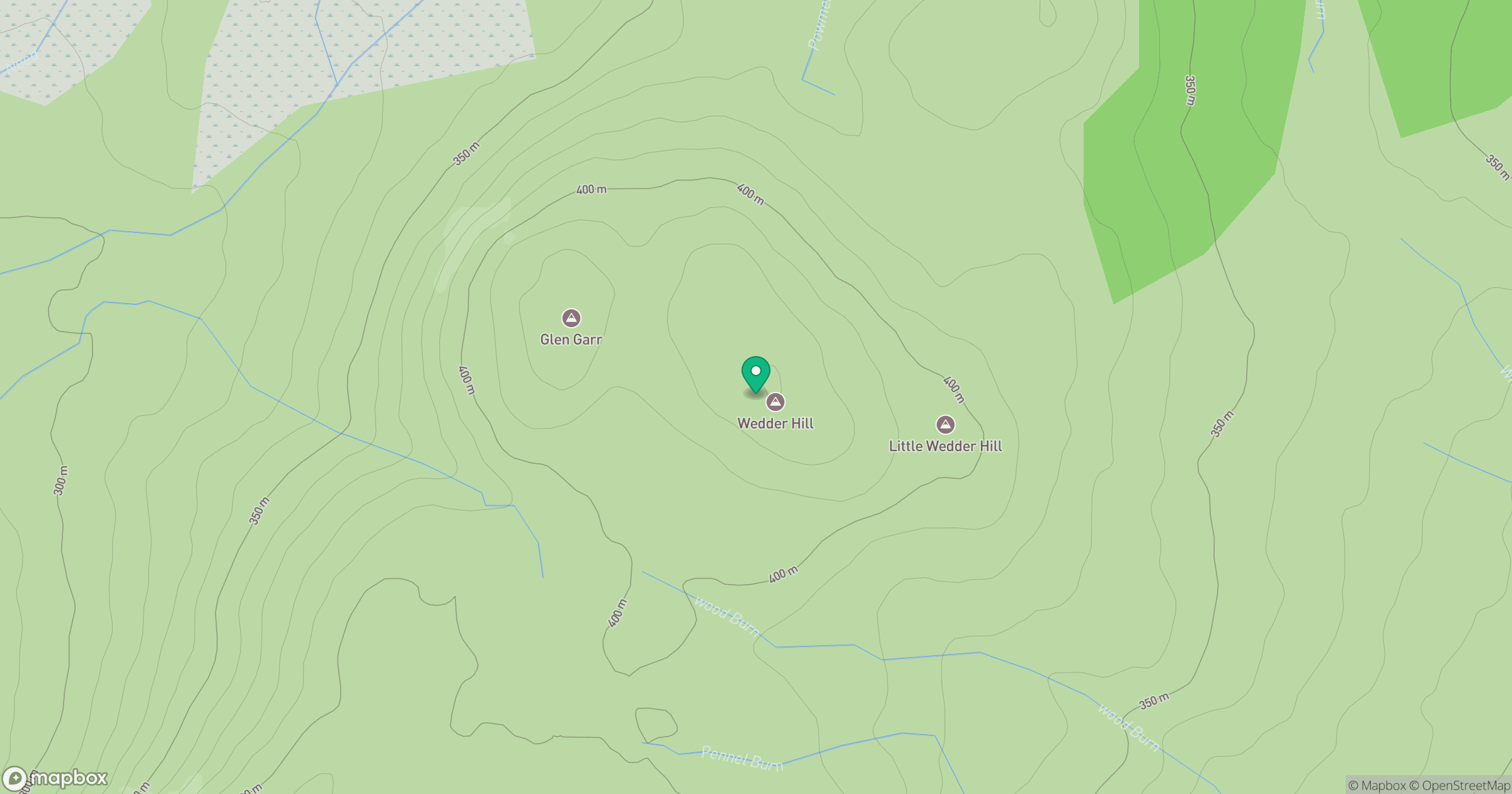
Grid reference: NS596308
View on OpenStreetMapOpens a map in a new tab, centred on the hill.
Hills within 30 km
Straight-line distance, not a walking route or confirmation of access.
No comments yet. Be the first.